


Exploring the Vital Role of Geographic Information Systems (GIS) in Coastal Erosion Control and Resilience Planning
Coastal counties of the United States are home to over 128 million people, or almost 40 percent of the nation’s total population, yet the coast accounts for less than 10 percent of the nation’s land mass [1]. Given these numbers, coastal erosion control is an important aspect of environmental management. Left unfettered, erosion poses a direct threat to landowners, ecosystems, and can directly impact the overall water quality of a region. When faced with the risk, municipal, state, and federal government agencies, as well as property owners and developers, are left with difficult decisions on how they can best protect and reinforce their land. Remote sensing and GIS provide an ever-expanding set of digital tools that can help monitor erosion rates, depict future projections, simplify complex data, and better apply erosion control infrastructure to at-risk regions. This discussion delves further into these use cases and evaluates how GIS can be applied to support erosion control and resilience planning along coastal areas.
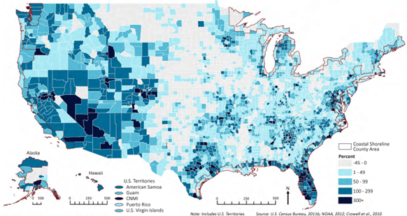
Figure 1: Percent Population Change in U.S. Counties, Highlighting Coastal Shoreline Counties: 1970-2020 NOAA [2]
A CREEPING THREAT
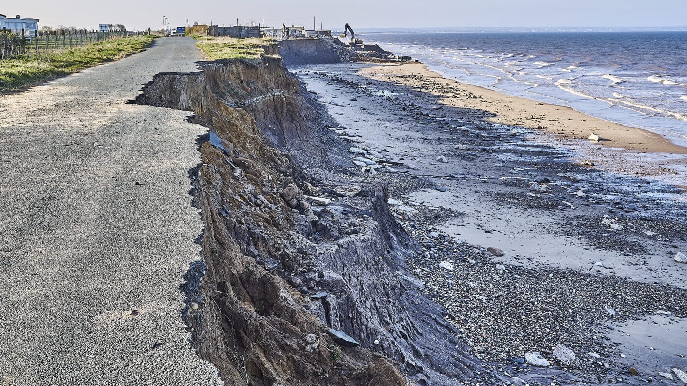
Coastal erosion occurs along shorelines due to wave action, storm surges, and rising sea levels. In the United States, coastal erosion is responsible for roughly $500 million per year in coastal property loss, including damage to structures and loss of land. In addition to beach erosion, more than 80,000 acres of coastal wetlands are lost annually—the equivalent of seven football fields disappearing every hour of every day. The aggregate result is that the United States lost an area of wetlands larger than the state of Rhode Island between 1998 and 2009. [3] The increasing frequency and intensity of storms and rising sea levels due to climate change are contributing to the intensity of coastal erosion. Hurricanes, in particular, can strip away protective sandy barrier islands, leaving regions vulnerable to future storm surges. Additionally, continuous wave and wind action gradually erodes beaches and shorelines, reducing their size and exposing human infrastructure to tidal forces and storms. [4]
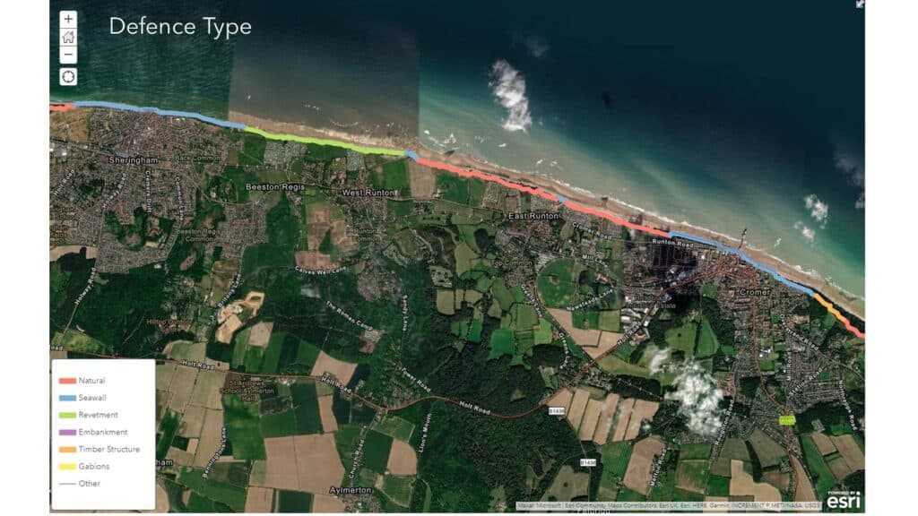
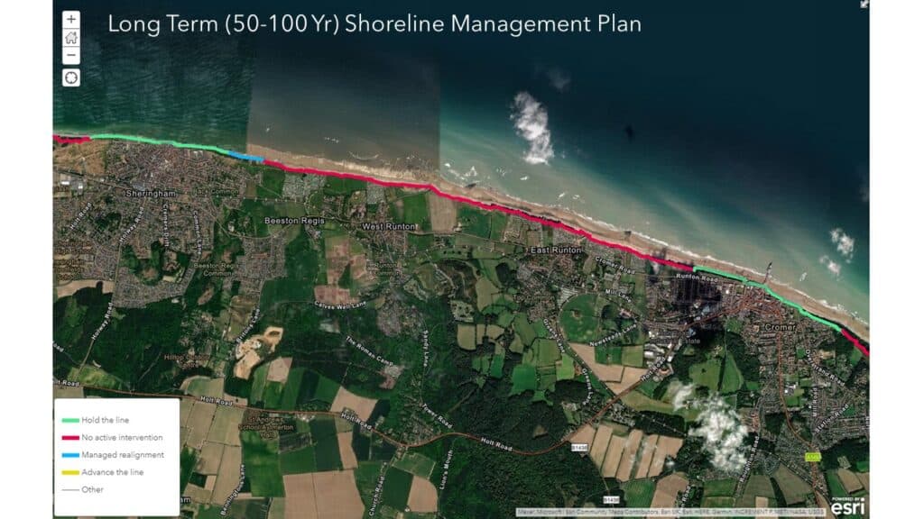
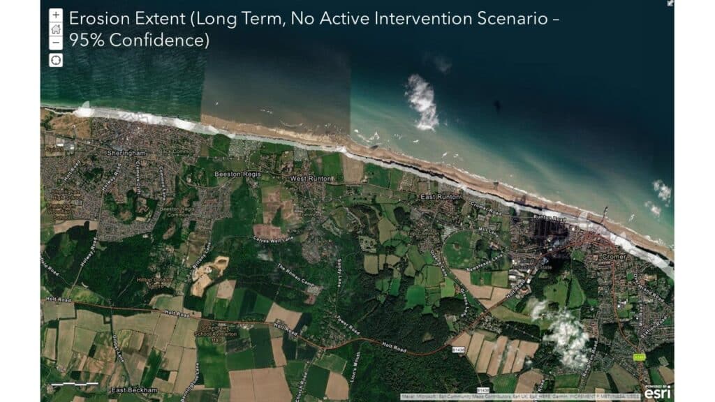
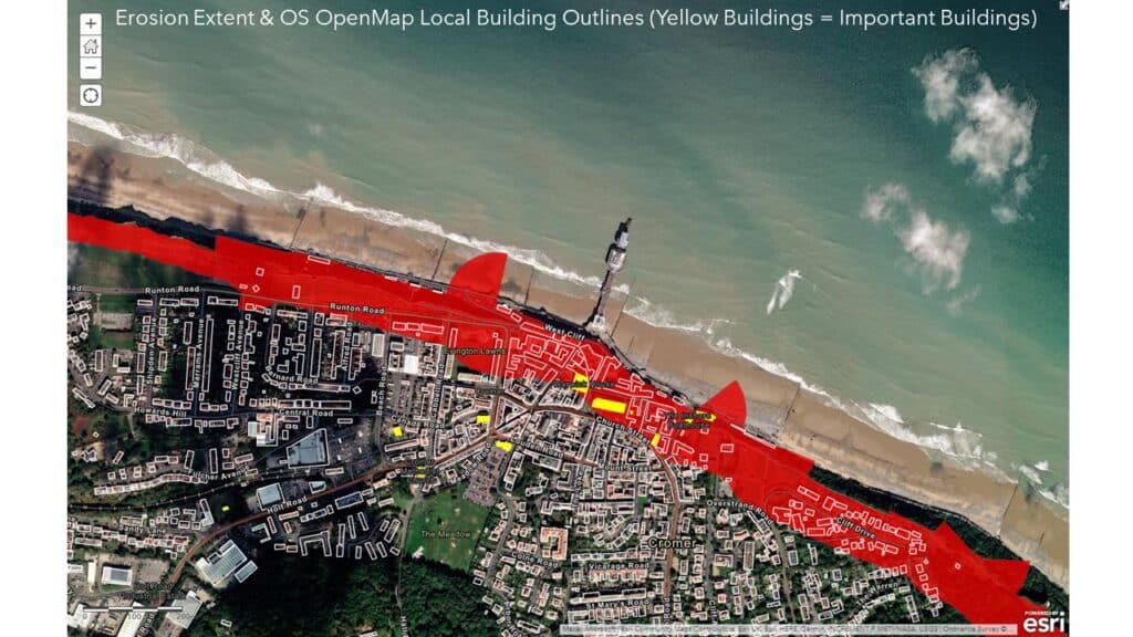
Figure 2: Basic GIS data sets that can be utilized to visualize shoreline management plans and condition [5].
THE ROLE OF GIS IN THE ONGOING DIALOGUE
Over the last decade we’ve seen a rising wave of interest centered around the utilization of remote sensing and GIS to monitor coastal erosion and its associated threats. Property owners and developers can face hurdles when assessing how to comprehensively translate risk into the decision-making process. To increase the resilience of human and natural habitats, the support of remote sensing and GIS technology can play an important role.
Below is a breakdown of how GIS can benefit your coastal development or resilience project:
Site Suitability Analysis:
GIS enables property owners to conduct variable based, site suitability analyses. This process can pinpoint areas where protection measures will likely be needed in the future by compiling and visually depicting complex datasets into simplified graphics. It is achieved through the overlaying of geographic data onto a digital map. This data can include broad details such as, tidal currents, wave energy, shoreline geomorphology, and historic and current boundaries or shorelines. It can also include more focused information within the region including marking critical infrastructure, listing the age of buildings along with their constructed material types, and listing information recorded in recent evaluations.
Erosion Control Planning and Slope Analysis:
GIS can aid in the development of erosion control plans by identifying critical areas for intervention within the landscape and can calculate slope gradients across coastal landscapes when paired alongside elevation data. This data can be crucial when identifying areas with steeper slopes that may be prone to accelerated rates of soil erosion.
Climate Change Considerations:
Beyond the existing conditions, GIS allows for the incorporation of climate change projections into soil erosion assessments. By factoring in future climate scenarios, planners can anticipate how changing precipitation patterns, stronger storms, and sea-level rise might exacerbate erosion risks and help to prepare communities in advance.
Monitoring and Adaptive Management:
Post-implementation, remote sensing paired with GIS can continue to be a valuable tool for erosion control as it provides the ability to performs real-time monitoring of shoreline conditions. These include monitoring visual and measured changes in sediment deposition, vegetation growth, and erosion rates. This data allows for ongoing adaptive management strategies, ensuring that the chosen approach remains effective over time.
Encouraging Digital Inclusion:
Sifting through spreadsheets and pages of reports can be an extremely cumbersome task and can act as a deterrent for some wanting to get involved with a multifaceted project. Whether you’re working with corporate partners or a local community, platforms like ESRI Map Viewer, allow users to create public facing maps and datasets that are easy to navigate online or offline. This immediate access means that participants can quickly and efficiently interact with mapped information, with little to no experience with the platform.
HOW CAN Vertex HELP?
Implementing Adaptive Management Strategies and accessing the full scope of a property’s vulnerabilities is an important aspect of designing solutions that are based on real-time data and evolving conditions. At Vertex we have a wide variety of experts that include Forensic Consultants, Geologist, Hydrologists, GIS Experts, and Engineers that can help you when assessing the challenges faced by coastal developments and existing coastal properties. To learn more about Vertex’s or to speak with an Expert, call 888.298.5162 or submit an inquiry.
References
| [1] | NOAA, “Economics and Demographics,” 2023. |
| [2] | NOAA, “National Coastal Population Report,” 2013. |
| [3] | U.S. Climate Resilience Toolkit, “Coastal Erosion,” 01 04 2021. |
| [4] | USGS, “Coastal erosion is more severe under climate change,” 01 2022. |
| [5] | ESRI, “Investigating Coastal Erosion & Management With GIS,”. |
| [6] | ESRI, “GIS Helps Integrate Coastal Hazard Risk and Sea Level Rise,”. |
Authored by: Lauren Williams