VERTEX uses cookies to make our website work properly and to provide the most relevant content and services to our clients and site visitors. View our Privacy Policy.
Decoding Soil Contamination: Pesticide Residues vs. Natural Arsenic
April 24, 2025
Share
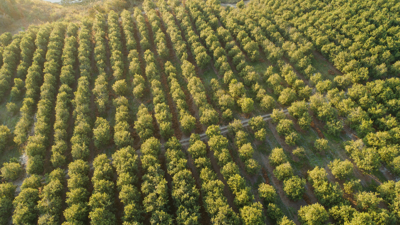
Soil contamination poses significant challenges for landowners, developers, and environmental professionals, especially when historical pesticide use overlaps areas with naturally occurring elements like arsenic. Lead arsenate, once a staple in orchards and other farmland, has left a persistent mark on the environment, complicating efforts today to redevelop what may appear to be clean agricultural properties in trying to distinguish anthropogenic residues from geological baselines. Drawing on guidance from the New Jersey Department of Environmental Protection (NJDEP) and peer-reviewed research, this blog explores how the lead-to-arsenic ratio and soil profile can help differentiate between anthropogenic (man-made) and natural background sources.
The Persistent Footprint of Lead Arsenate
From the late 19th century to the mid-20th century, lead arsenate was widely applied to control pests in fruit orchards across the U.S. and beyond. Its elemental components, lead and arsenic, don’t break down, accumulating in surficial soils where they were sprayed. Research by Peryea and Creger (1994) underscores this legacy, noting that in contaminated soils, these metals remain concentrated in surface layers decades after application, often at levels exceeding regulatory standards. Yet arsenic also occurs naturally in many regions, tied to mineral-rich bedrock or glacial deposits. For stakeholders, pinpointing the source of elevated arsenic is critical for effective remediation and affects the bottom line.
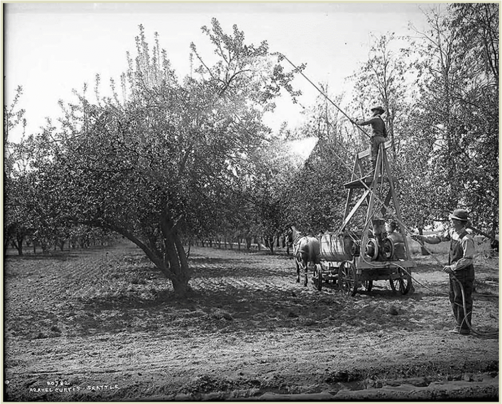
historical orchard image
Image: Courtesy Washington State Historical Association
The Lead-to-Arsenic Ratio: A Diagnostic Clue
NJDEP guidance highlights a key evaluation tool. In soils impacted by lead arsenate, surficial samples often show a lead-to-arsenic ratio of about 4:1. For example, 80 milligrams per kilogram (mg/kg) lead with 20 mg/kg arsenic reflects the pesticide’s chemical signature. This consistency flags historical pesticide use, termed “HAP” (historically applied pesticide) residuals. In contrast, naturally elevated arsenic typically shows no such correlation, with lead levels often below 50 mg/kg, as geological sources rarely co-deposit these metals in fixed proportions.
This ratio is actionable. If initial sampling flags arsenic above a regulatory standard (e.g., NJDEP’s 19 mg/kg), the inclusion of lead in follow-up tests can clarify its origin. A 4:1 ratio suggests the source may be more likely pesticide residues, while low, uncorrelated lead concentrations suggest more likely a natural source. These insights can save time and resources in developing an appropriate remedial strategy or when deciding to purchase a property for residential development.
When Sources Collide: A Deeper Look
Complexity arises when pesticide residues and natural arsenic coexist. Surficial soils might show the 4:1 ratio (e.g., 100 mg/kg lead, 25 mg/kg arsenic), but deeper samples could reveal a sharp drop in lead (e.g., 10 mg/kg) with persistent or rising arsenic (e.g., 40 mg/kg). NJDEP notes this pattern, pesticide impacts fade with depth while natural arsenic may increase, reflecting distinct contamination zones. Peryea et al. (1994) observed elevated lead and arsenic in surface soils from historical pesticide use, contrasting with deeper layers, emphasizing the need for vertical profiling.
In these cases, a detailed soil analysis is essential. Sampling at multiple depths maps the transition from anthropogenic to natural sources. If deeper arsenic exceeds 19 mg/kg consistently, a site-specific background study—using undisturbed areas or regional data, can establish a natural baseline. Remediation then targets only the surficial pesticide layer above that level, a practical approach grounded in both NJDEP guidance and scientific findings.
Steps to Act On
Stakeholders can navigate this with a clear plan:
Profile the Soil: Test lead and arsenic to vertically profile and separate pesticide zones from natural ones.
Apply the Ratio: NJDEP identifies that a 4:1 lead-to-arsenic ratio in surface soils signals potential pesticide impact.
Set a Baseline: Establish a site-specific natural arsenic level if deeper soils exceed standards.
Focus Cleanup: Remediate surficial HAP residuals to the site-specific baseline, not an unattainable default.
Partner with Regulators: Use ratio data and profiles to justify tailored solutions. Involve regulators early in the investigation and planning process.
Consider a former orchard: Surficial samples show 80 mg/kg lead and 20 mg/kg arsenic, while deeper soils hit 40 mg/kg arsenic with negligible lead. Excavating the top layer alone can address the pesticide contamination, leaving natural levels intact, a strategy validated by decades of research that can save time and money.
Why It’s Critical
Distinguishing arsenic sources streamlines remediation, cuts costs, and ensures compliance while still protecting receptors. Misidentifying pesticide sources can lead to overzealous cleanups, while understanding natural baselines prevents unnecessary effort. For developers, it shapes safe land use; for regulators, it anchors evidence-based decisions. At VERTEX, we turn complex soil data into clear, actionable plans. Facing a contaminated site? Contact us to tackle your challenge with science-backed precision, because sustainable solutions start with knowing what’s beneath.
For more information or to discuss soil contamination assessments, connect with Daniel Gardner, LSRP, Director of Remediation, Compliance & Regulatory Services, or explore our Compliance & Regulatory Services to see how VERTEX can support your next redevelopment project.
References
New Jersey Department of Environmental Protection (NJDEP). (2022, February). Historically Applied Pesticides (HAP) Guidance Document (Version 3.1).
Peryea, F. J., & Creger, T. L. (1994). Vertical distribution of lead and arsenic in soils contaminated with lead arsenate pesticide residues. Water, Air, and Soil Pollution, 78, 297–306.
Daniel Gardner is the Director of Remediation at VERTEX and Licensed Site Remediation Professional (LSRP) with extensive site remediation experience. Since 1999, Mr. Gardner has managed and provided technical and regulatory oversight for a full range of environmental investigation and remediation projects.